
Protected Areas
Explore Central Alberta's Protected Areas
Explore Central Alberta's Protected Areas
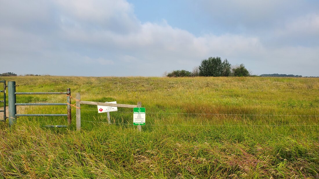
RULES AND AMENITIES FOR ALL PaRKLAND AREAS
|
Rules:
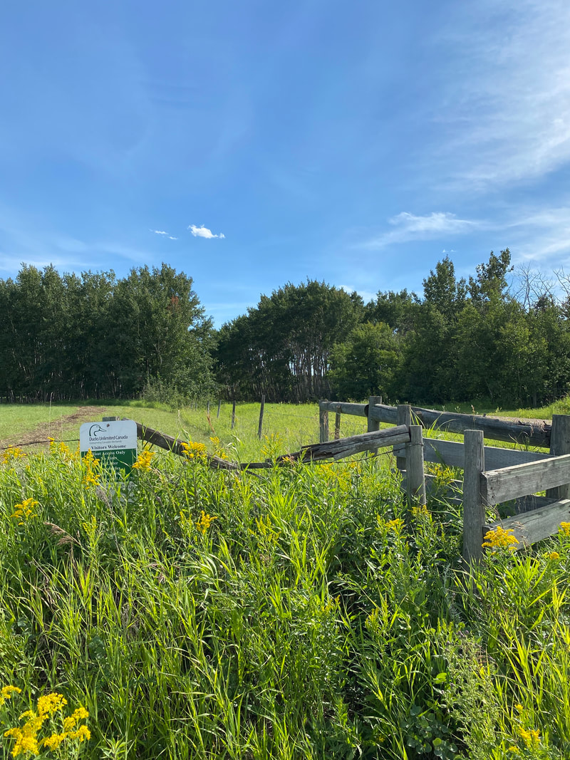
Hiking allowed Day use only No open fires Foot access only Dogs: Please note that protected areas are some of the last remaining places where wildlife can live their lives in peace. Dogs frighten, chase and even kill wildlife. Please respect the wildlife and do NOT bring your dog (leashed or unleashed) to these areas. Hazards: livestock may be present intermittently on some sites, leave gates as you find them. Consent Prior to Entry: May be required on some sites (dogs must be under control, preferably on a leash, at all times). |
Amenities:
Bathrooms: Most have no bathrooms available, there are some exceptions Trash: Most have no garbage facilities. Please bring your trash home. Parking: Most have limited parking, or parking along ditches near area Hazards: Tripping and falling, wild animals - be prepared, bring bear spray. |
Feltham - #102 in Alberta Discover Guide - 75.5 km from Red Deer
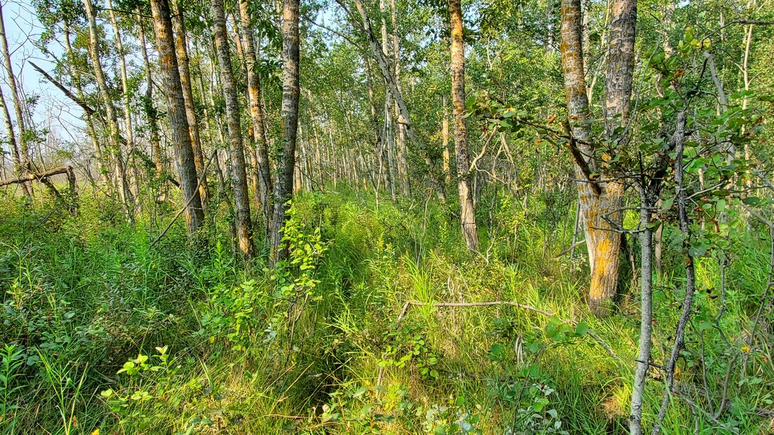
This 800-acre site is at the NE end of Buffalo Lake in the Buffalo Lake Moraine. To access this site from Stettler, travel N on Highway 56 for 20.8 km, then turn W on Twp Rd 412 for 6.4 km, keep to the right at the Y in the road, and turn N on RR 202 for 0.8 km to the parking lot. The site consists of rolling hills, aspen bluffs, wetlands, tame forage and dense nesting cover. Wildlife in the area includes white-tailed and mule deer, moose, grouse and waterfowl.
Partners: Alberta Conservation Association, Alberta Environment and Parks
https://www.albertadiscoverguide.com/site.cfm?grid=E3&number=102


Highway 53 - #154 in Alberta Discover Guide - 76 km from Red Deer
This 148-acre site is approximately 10 km E of Bashaw and consists of wetland, grassland and bush habitat. Wildlife in the area includes white-tailed deer and waterfowl.
Access: East of Bashaw 11.2 km on Highway 53. Located on the north side.
Partners: Ducks Unlimited Canada
https://www.albertadiscoverguide.com/site.cfm?grid=E3&number=154
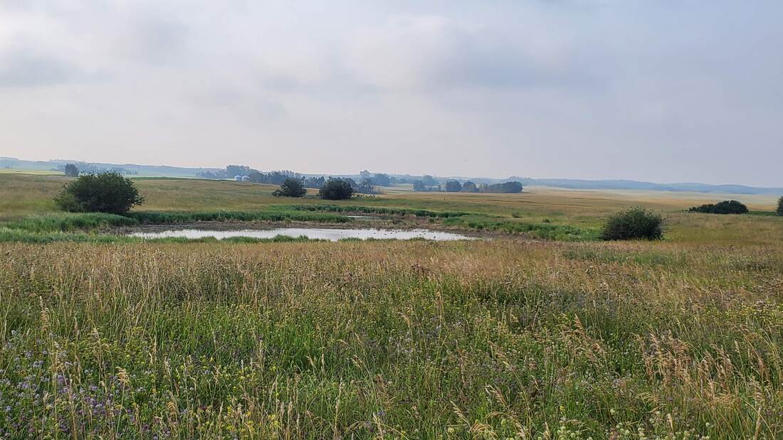
Klassen (76.3 km)
Situated southeast of Wetaskiwin, this conservation site showcases a landscape dominated by open fields and grasslands, with some scattered groves of bushes concentrated in the center. In the northeastern direction, a visible Hutterite colony can be observed. Within the conservation site, there is a sizable acreage which is located on the same quarter but on the east side. Keep in mind there may be cattle grazing the site, which can be seen from the road. While there are few wetlands present on-site, it may not be worth planning a dedicated trip unless you happen to be passing by. Noteworthy bird species that can be spotted in the area include the Black-capped Chickadee, Song Sparrow, Cedar Waxwing, and Great Blue Heron.
Access: Travel east on Highway 613 from Wetaskiwin for a distance of 6.5 km. Then, make a southbound turn onto Highway 822 and continue driving for approximately 16 km until you reach Highway 611. Take a left turn onto Highway 611 and proceed for another 11 km. Afterward, make a southbound turn onto Range Road 222. In less than 1 km, you will find the destination situated on your right-hand side.
Partners: DUC
Alberta Discover Guide: D3-120
Hilwill - #36 in Alberta Discover Guide - 76.4 km from Red Deer
This 175-acre site is approximately 10 km NW of Bashaw and consists of wetland, grassland and bush habitat. Wildlife in the area includes moose, white-tailed and mule deer.
Partners: Ducks Unlimited Canada
https://www.albertadiscoverguide.com/site.cfm?grid=E3&number=36
This 175-acre site is approximately 10 km NW of Bashaw and consists of wetland, grassland and bush habitat. Wildlife in the area includes moose, white-tailed and mule deer.
Partners: Ducks Unlimited Canada
https://www.albertadiscoverguide.com/site.cfm?grid=E3&number=36
Rockeling Bay/Rider Lake - #134 in Alberta Discover Guide - 76.5 km from Red Deer
This 167-acre site is approximately 12 km SE of Bashaw and consists of wetland, grassland and bush habitat. Wildlife in the area includes moose, white-tailed deer and waterfowl.
Partners: Ducks Unlimited Canada
https://www.albertadiscoverguide.com/site.cfm?grid=E3&number=134
This 167-acre site is approximately 12 km SE of Bashaw and consists of wetland, grassland and bush habitat. Wildlife in the area includes moose, white-tailed deer and waterfowl.
Partners: Ducks Unlimited Canada
https://www.albertadiscoverguide.com/site.cfm?grid=E3&number=134

Birch Lake (76.6 km)
Upon arriving at Birch Lake, you'll discover a parking lot equipped with official signage, garbage facilities, and washroom amenities. To access the lake itself, you'll need to descend a gentle slope with a trail often used as a boat launch. Upon reaching the shore, you'll find some game trails that assist in tracing the lake's edge. From this vantage point, you can observe a diverse range of birds, including the Great Blue Heron, and even witness osprey catching fish. As this lake offers numerous sport fishing opportunities, anglers frequently visit the area. However, please be aware that the roads leading to this location are unpaved and subject to weather conditions.
Access: Travel west from Caroline on Highway 54. Turn south onto Range Road 63 and continue for 13 km. While most of the drive is on paved road, you'll need to turn right onto an unnamed gravel road and follow it until you reach Birch Lake (approximately 2.7 km). NOTE: If you turn onto Township Roadd 351C by Burnstick Lake, you've gone too far.
Partners: ACA, AEP, Braxxon Excavation, Compton Petroleum, North Shore Environment Consultants, RTC Services Ltd., TAQA North
Alberta Discover Guide: E3-52
Hubert 1 (77.1 km)
Approximately 11 km North of Erskine, this 150-acre area comprises a combination of wetland, grassland, and bush habitats. The bush habitat is mainly made up of aspen and poplar groves with a significant amount of deadfall on the forest floor. The site also presents an opportunity for Saskatoon berry picking. Access to the area is marked with signage, and from there, you'll find a lease road leading to an old oil well. By following this road, you'll eventually reach a wetland situated on the southern side. Throughout the property, you'll notice pounded posts without wire and old cow patties, indicating past grazing by cattle. As you approach the wetland, you'll come across game trails, old wooden planks, some wire, and discarded tires. However, if you continue further up towards the lease, you'll be able to ascend a hill that provides an excellent vantage point, allowing you to oversee the entire site. This area is home to various wildlife, including white-tailed and mule deer, as well as waterfowl such as the Mallard Duck. Keep in mind that there might be livestock present, so it's advisable to contact the leaseholder for additional information before exploring the site.
Access: Starting at Mirror, proceed south on Highway 21 for a distance of 6.7 km. Then, head east on Highway 601 and continue along it for 16 kilometers until you reach Range Road 205. Once you've reached Range Road 205, turn north, and after traveling 2 km, you'll find the destination on your left-hand side. Keep an eye out for DUC (Ducks Unlimited Canada) signage, which should lead you to an oil lease road and gate.
Partners: DUC
Alberta Discover Guide: E3-23
Lickert - #76 in Alberta Discover Guide - 77.5 km from Red Deer
This 159-acre site is approximately 13 km SE of Bashaw and consists of wetland, grassland and bush habitat. Wildlife in the area includes white-tailed and mule deer and waterfowl.
Access: Head east 14 km from Bashaw on Highway 53 and south for 3.2 km on Range Road 201. Lickert will be on your right hand side when you turn east.
Partners: Ducks Unlimited Canada
https://www.albertadiscoverguide.com/site.cfm?grid=E3&number=76
Westview West - #18 in Alberta Discover Guide - 78.1 km from Red Deer
This 130-acre site consists of wetland, grassland and bush habitat. Wildlife in the area includes moose, white-tailed and mule deer and waterfowl.
Access: Head east 14 km from Bashaw on Highway 53 and south for 0.8 km on Range Road 201. It is on the east side of the road.
Partners: Ducks Unlimited Canada
https://www.albertadiscoverguide.com/site.cfm?grid=E3&number=18
Westview East - #30 in Alberta Discover Guide - 78.9 km from Red Deer
This 160-acre site consists of wetland and grassland habitat. Wildlife in the area includes moose, white-tailed and mule deer and waterfowl.
Access: Head east 14 km from Bashaw on Highway 53 and south for 0.8 km on Range Road 201. It is a joining quarter to the east of Westview West.
Partners: Ducks Unlimited Canada
https://www.albertadiscoverguide.com/site.cfm?grid=E3&number=30
Midway Reservoir (78.3 km)
This property holds a charming pond, located to the east of Carstairs. Each season, the pond is stocked with rainbow trout, making it ideal for fishing enthusiasts. Alongside its opportunities to fish, Midway Reservoir offers various amenities to enhance visitors' experiences, including picnic tables, fire pits, and conveniently situated outhouses. Furthermore, Midway Reservoir provides a modest campground for those seeking an immersive outdoor experience. While the campground does not offer water or electricity, campers are encouraged to bring their own generators and drinking water. Surrounded by idyllic farm fields, this peaceful setting serves as an ideal weekend getaway from the bustling city. As a dog-friendly location, visitors are welcome to bring their furry companions; however, it is kindly requested to keep them leashed during the stay.
Access: Head east on Highway 581 for a distance of 19 km. Continue onto Township Road 302. After 6.5 km, take a left turn onto Range Road 273 and another left, which will lead you into the entrance of Midway Reservoir.
Partners: ACA, AEP, Midway Centennial Park
Alberta Discover Guide: E3-142
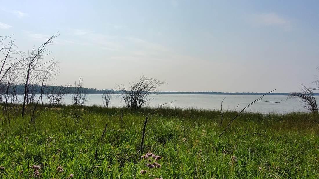
Rochon Sands Provincial Park – 80.4 km from Red Deer
This natural area is within a campground but there are trails that wind through the campground and along Buffalo Lake. This area is rich in plant and animal diversity. Many different wetland bird species utilize this area some examples are White-faced ibis, Spotted Sandpiper, Marsh Wrens and American White Pelicans.
Partners: Alberta Environment and Parks
https://www.albertaparks.ca/parks/central/rochon-sands-pp/

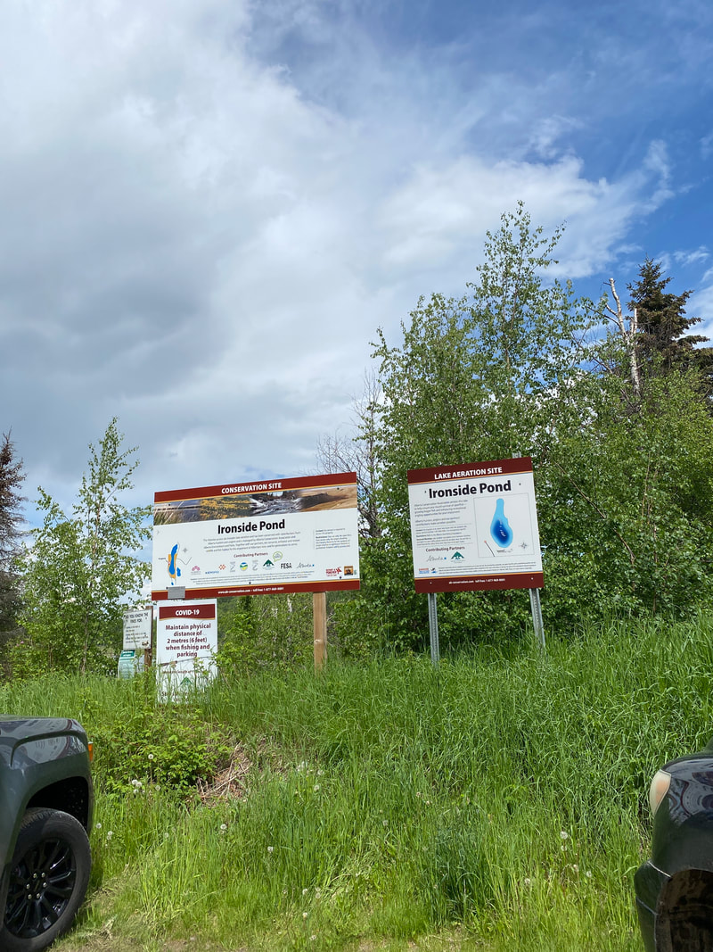
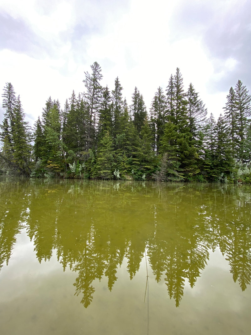
Ironside Pond - Lake Aeration (80.6 km)
This property is situated northwest of Caroline, offering convenient accessibility for visitors. The western side of the pond features parking space for 5 or more cars, complemented by informative signage. This area caters to both fishing enthusiasts and those seeking road-side views of waterfowl. The pond is regularly stocked with trout and benefits from aeration. On the eastern side, road-side viewing is also possible, granting visitors a view overlooking the pond. Notable species to keep an eye out for include the Orange-crowned Warbler, Rose-breasted Grosbeak, and Warbling Vireo. However, it's important to note that Ironside Pond lacks hiking paths, washrooms, or garbage facilities. The location is also positioned on a dead-end road, in close proximity to oil leases.
Access: To access the site, head west on Highway 54 from Caroline. Upon arriving at the Clearwater Trading Post, make a right turn onto Highway 22 / Cowboy Trail. After traveling 15 km, take a left onto Township Road 38-0, followed by continuing on Township Road 375A. In another 10 km, make a right turn onto Range Road 8-0. Continue by turning right onto Township Road 380, and follow the road until you encounter a fork marked with Ironside Pond signage, approximately 2 km.
Partners: ACA, AEP, Alberta Lottery Fund, Clearwater County, Keyera Energy, Northern Lights Fly Fishers, Trout Unlimited Canada Edmonton
Alberta Discover Guide: E2-6
Pennock Property - 81.0 km from Red Deer
This 156-acre site is a beautiful mosaic of thick aspen forest, grassland and upland shrub habitat. The hilly landscape was created by receding glaciers. The animals that can be found here include: White-tailed and mule deer, muskrat, coyote, red fox, forest birds, waterfowl and grassland birds.
Partners: Ducks Unlimited Canada, Nature Conservancy of Canada.
This area requires booking, to book please visit the NCC website: https://connect2nature.ca/
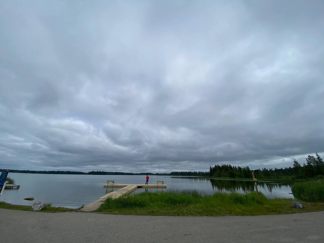
Mitchell Lake - #3 in Alberta Discover Guide – 81.7 km from Red Deer
This 46-acre site is approximately 19 km SW of Rocky Mountain House and offers sport fishing opportunities. Camping facilities, outhouses and garbage bins (managed by AEP) are available. There are also three floating docks and a dirt boat launch open for public use. AEP stocks this lake annually with trout, and it is aerated (October - April) through ACA's Lake Aeration Program.
Partners: Alberta Conservation Association, Alberta Environment and Parks, Alberta Lottery Fund, Anger Enterprises Ltd., Rocky Fish & Game Association
https://www.albertadiscoverguide.com/site.cfm?grid=E2&number=3

Greenwall (84.5 km)
Just southeast of Wetaskiwin lies Greenwall, a 640-acre site. This property boasts dense vegetation and is crisscrossed by game trails. As you explore, you'll come across wetlands, lush forest canopies, and features of parkland habitat. In the site's northeast corner, a river provides a natural pathway and hibernation spot for garter snakes during the winter. This area is a great location for ungulates and songbirds, including species like the Yellow Warbler, Warbling Vireo, American Goldfinch, and Baltimore Oriole. Parking is available, but there are no washrooms or garbage facilities on-site.
Access: From Bittern Lake, travel east on Highway 13. Turn right onto Range Road 215 and proceed on Township 461. Then, make a left turn onto Range Road 220. After about 2.4 km, turn right onto Township Road 460. Continue for 7 km, and you'll find the parking lot entrance conveniently on your left.
Partners: ACA, AEP
Alberta Discover Guide: D3-53
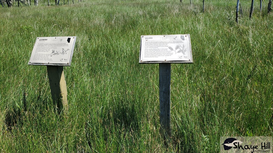
Bashaw Centennial Nature Trail (84.6 km)
The Centennial Nature Trail in Bashaw provides an opportunity for town residents to break away from their daily routines and connect with nature. Most of the hiking trails are covered in gravel and equipped with benches and interpretive signs, ensuring an enjoyable journey through the aspen and mixed forests. The trail meanders through wetland areas and a large pond where a gazebo provides a resting spot. It skirts around half of the pond, offering better views of the water and waterfowl present. From the shore, birdwatchers have the opportunity to observe various species, including the Goldeneye, Redhead, Northern Shoveller, Bufflehead, Greater Yellowlegs, and American Coot. Residential housing borders the southwest corner of the nature trail and site. Activities throughout the seasons include ice fishing, cross-country skiing, and snowmobiling in the winter.
Access: Starting from the Bashaw intersection, head north on Highway 21, then make a right turn onto 50 Avenue. Take a left onto 52 Street, and after a distance of 0.7 km, make a right turn onto 55 Avenue. The entrance to the site will be located ahead.
Partners: Town of Bashaw
Alberta Discover Guide: N/A
Arnold (85.0 km)
In general, this site is still relatively new to the ACA. For this reason, there is no official signage displayed on the property yet. The location encompasses Hatfield Lake, situated alongside the highway, and features a minimum of three wetlands. On its southern side, an oil facility and an active hay field can be found. To define its boundary, Arnold is enclosed by a fence. From the highway, species of waterfowl can be observed, including the Horned Grebe, Bufflehead, American Coot, Ruddy Duck, and Canvasback.
Access: Begin by heading west from the Bashaw Intersection on Highway 605. Subsequently, turn left (south) onto Range Rd 220/Township Rd 415A. Feel free to park along the road in the ditch.
Partners: ACA
Alberta Discover Guide: N/A
Hatfield Lake (85.0 km)
This lake exists on either side of Highway 605 and is surrounded by trembling aspen trees. It serves as an excellent spot for naturalists keen on observing waterfowl or individuals seeking opportunities to kayak. Behind the lake and to the south, exists a newer ACA property called Arnold. While visiting, be on the lookout for various waterfowl species, including the Cinnamon Teal, Lesser Scaup, Redhead, and Ruddy Duck.
Access #1: For road-side viewing, head west from Bashaw on Highway 605. Continue 3.4 km until the highway divides Hatfield lake into two. NOTE: Do not leave vehicles unattended on the highway.
Access #2: Head west from Bashaw Intersection on Highway 605. Turn left (south) onto Range Rd 220/Township Rd 415A. Park along the ditch.
Partners: DUC
Alberta Discover Guide: N/A
Lawson (85.4 km)
This 312-acre area is situated approximately 14 km north of Stettler and comprises a diverse combination of wetland, grassland, and bush habitats. Access to the property is available from both the east and west sides. If you choose to approach from the east, you'll encounter a wetland area and a location where bee huts are kept. On the other hand, accessing the site from the west will lead you to more open spaces with wetlands, accompanied by proper signage. Within the property, an old trail provides a convenient route for navigating through the landscape. Along this trail, you'll have the opportunity to explore rolling hills and aspen groves adorned with Saskatoon berry bushes. However, please be aware that this is an active grazing site with cattle, and for your safety and proper awareness, it is strongly recommended to contact the leaseholder for more information before entering the area.
Access: From Alix, head east on Highway 601 for 27 km. Turn north onto Range Road 202 and proceed for 5.2 km until you come across an approach on the right-hand side, marked with DUC (Ducks Unlimited Canada) signage.
Partners: DUC
Alberta Discover Guide: E3-63
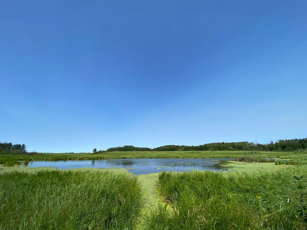
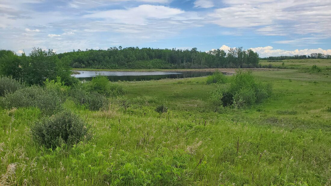
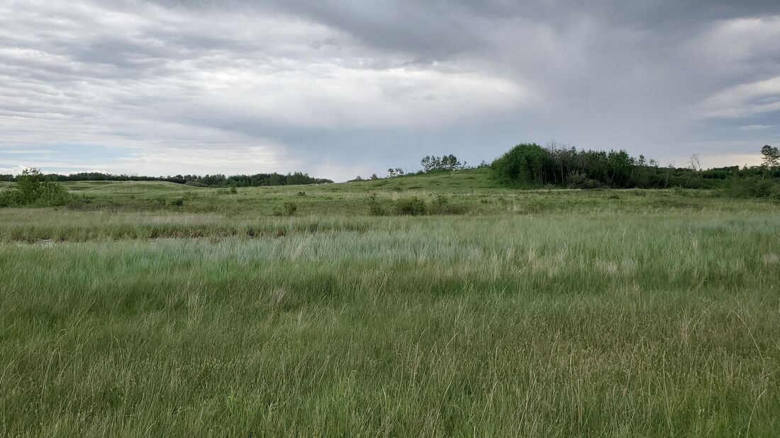
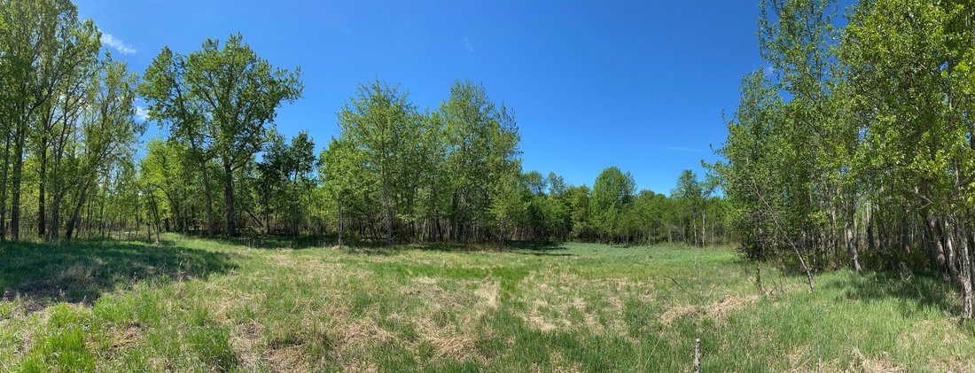
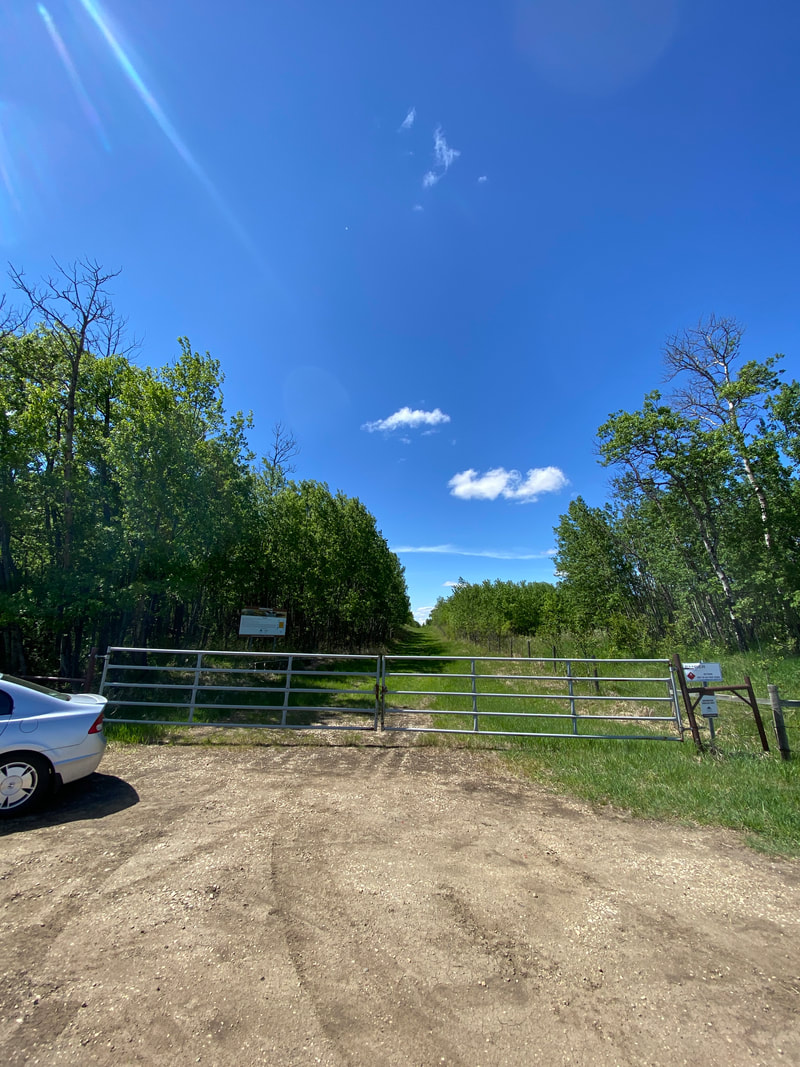
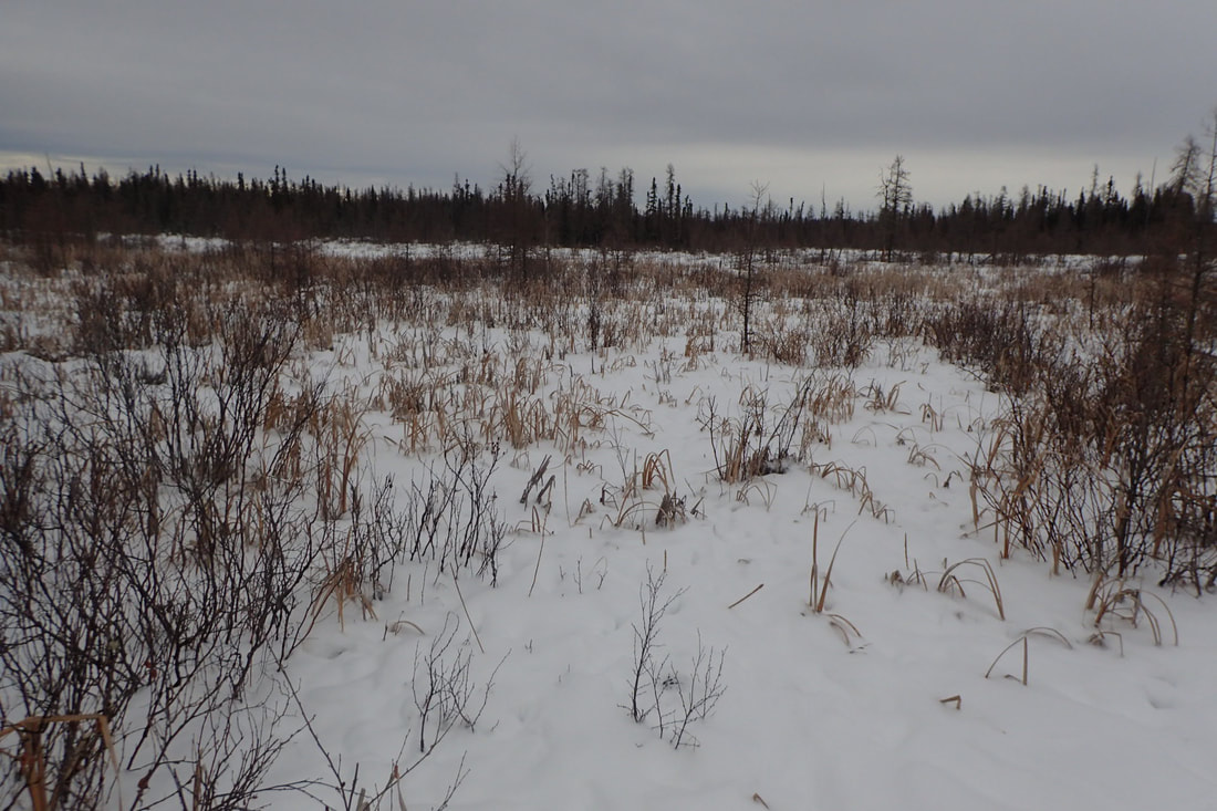
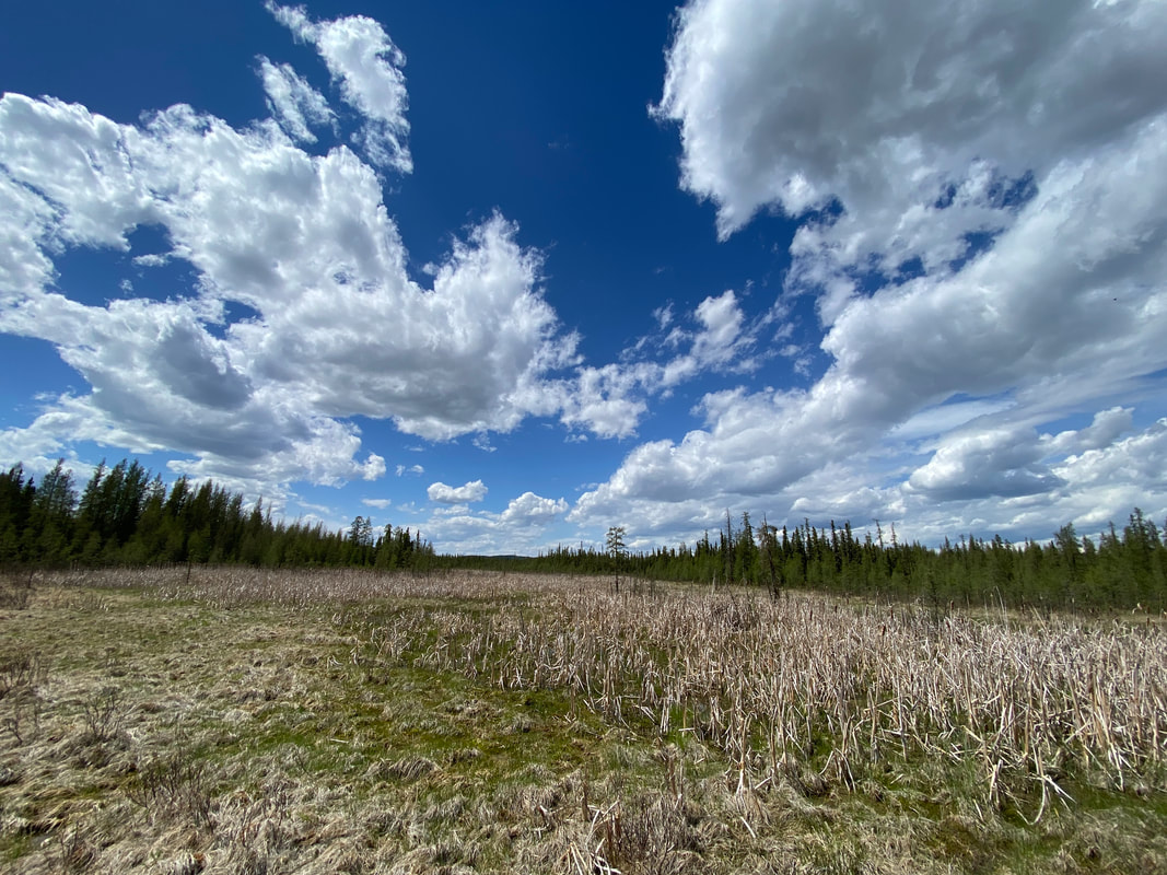
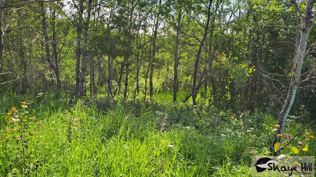
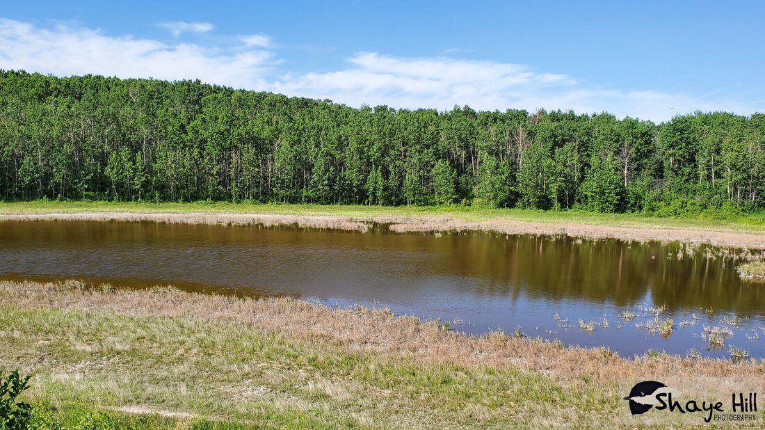
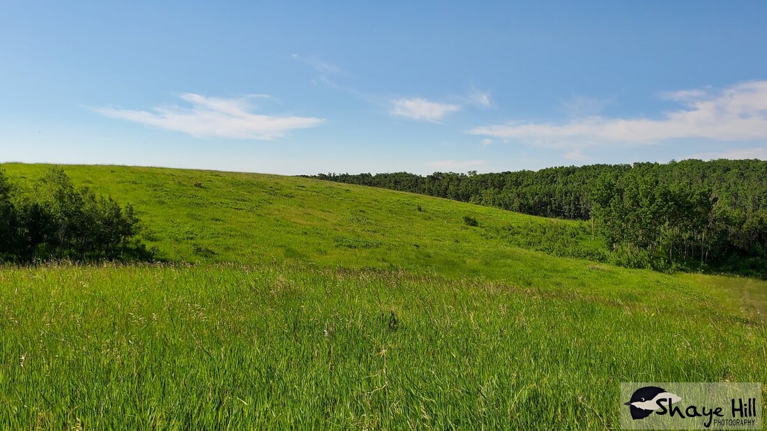
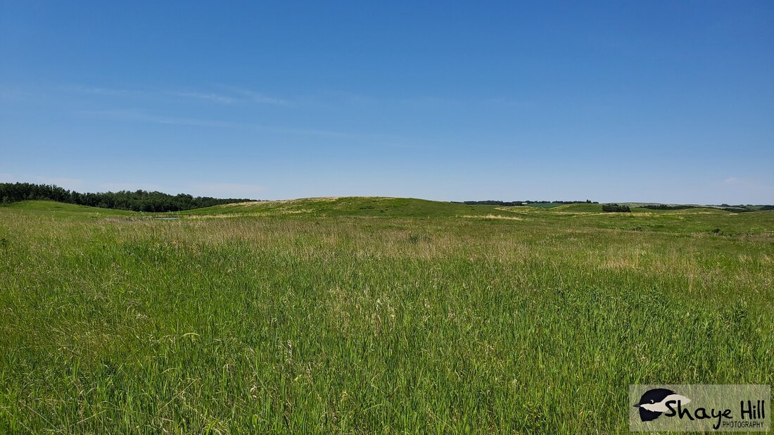
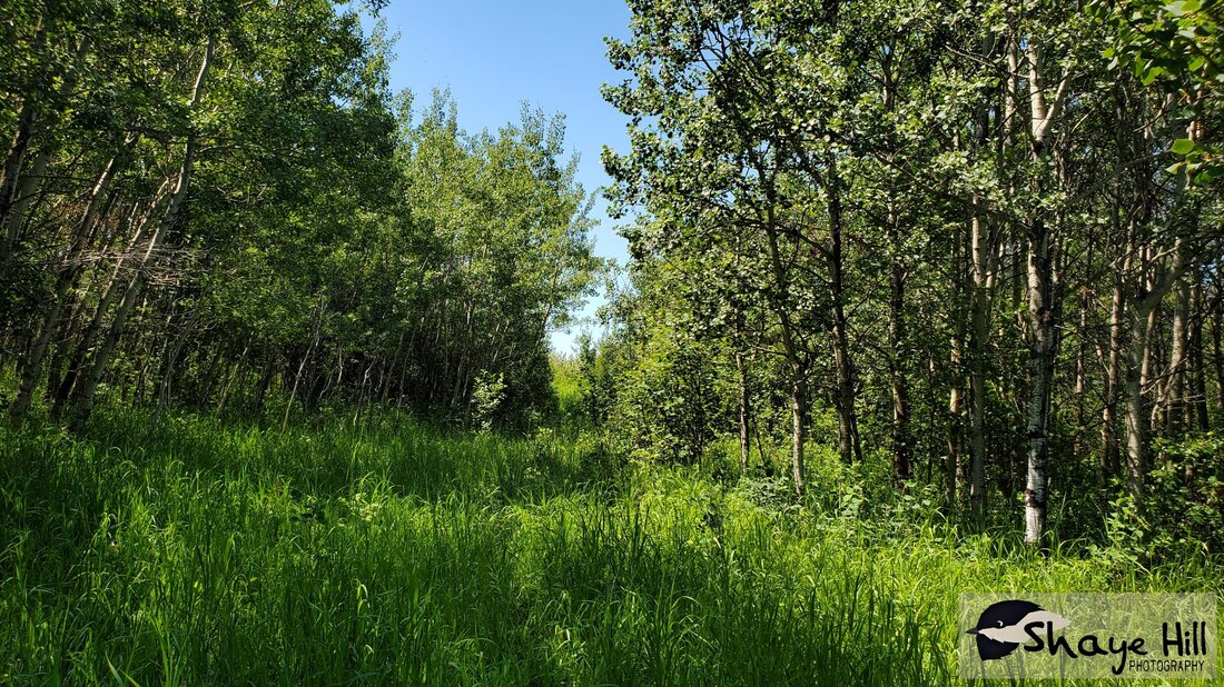
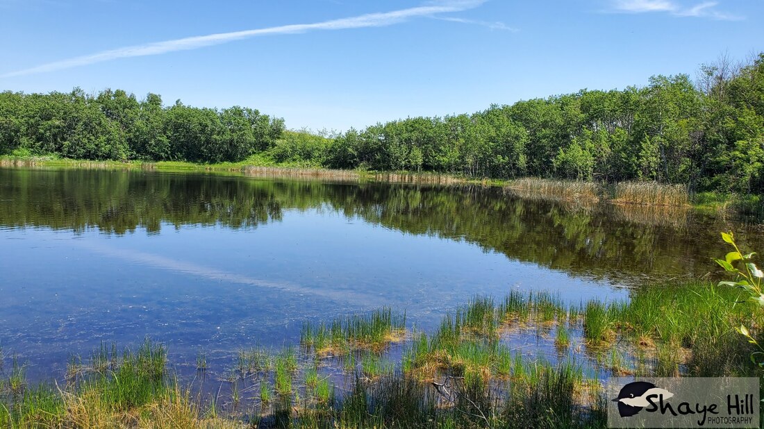
Fyten-Lea – 85.5 km from Red Deer
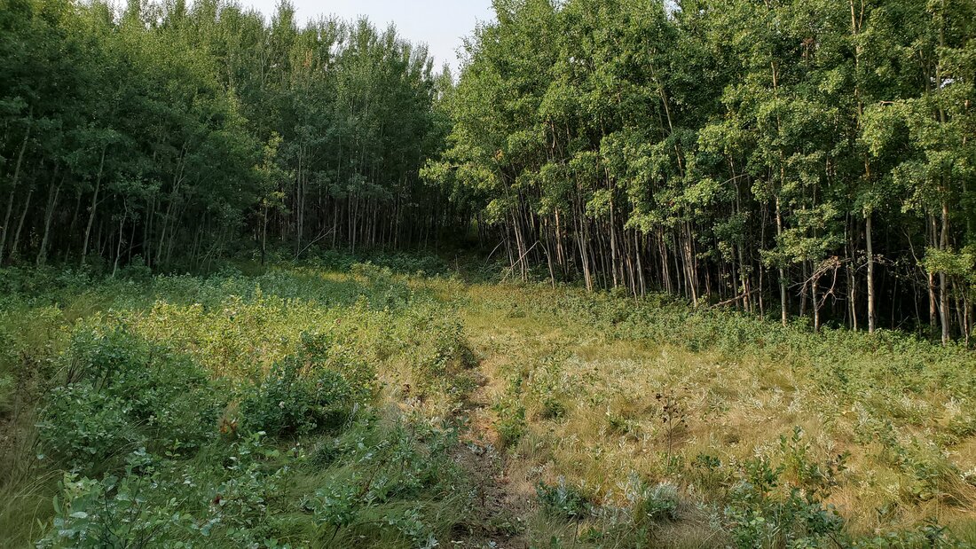
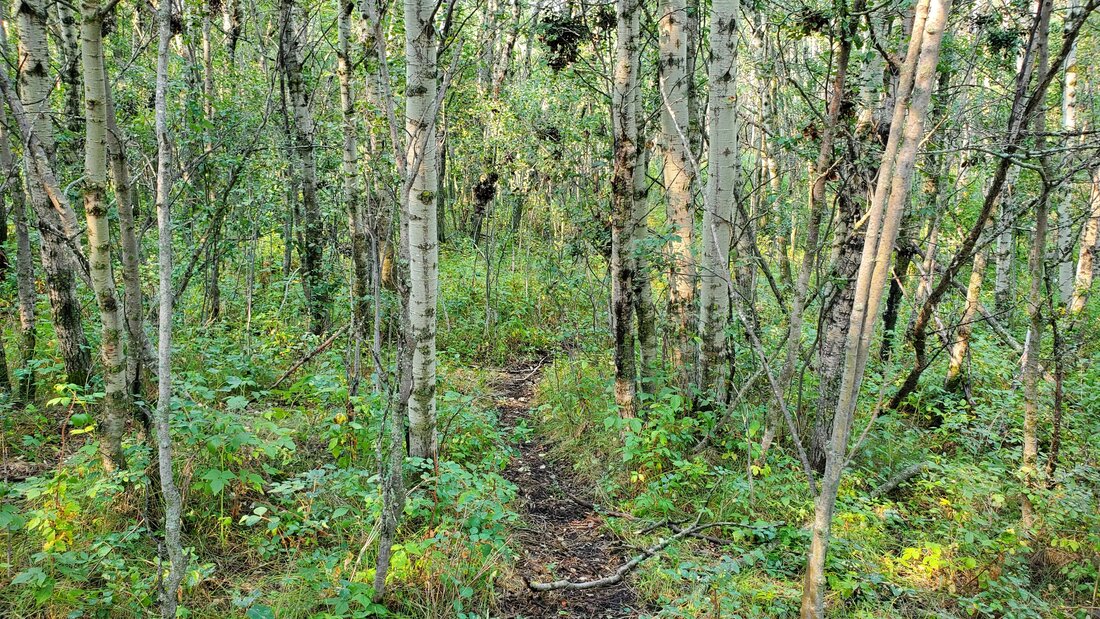
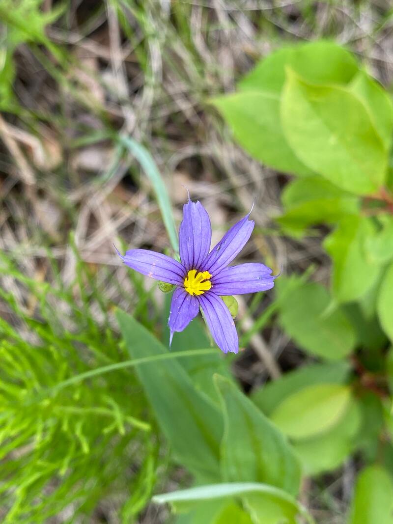
This is a 121-acre natural area nestled along the Red Deer river east of Big Valley. It offers unique habitat for birds, mammals, reptiles, and amphibians. It has young aspen stands throughout the site scattered among prairie grasslands that offer a spectacle of blooming wildflowers in the spring and summer months.
To access this area from Red Deer head east on Highway 595, turn south on Highway 21, and east again on Highway 590. Head south on Range Road 21-5 until Township Road 35-2 where you continue east again until 21-4, head north on 21-4 until the end of the road and park along the fence line on the right hand side. There is a residence at the end of the road, do not go into the residence. I've included a zoomed in map with a red triangle on where to access the area. Follow all safety protocols and be aware of steep terrain, hidden holes and animals. I highly caution against traveling through this area alone. Images here.
Partners: Nature Conservancy of Canada
This area requires permission to access please visit NCC website to book: https://connect2nature.ca/
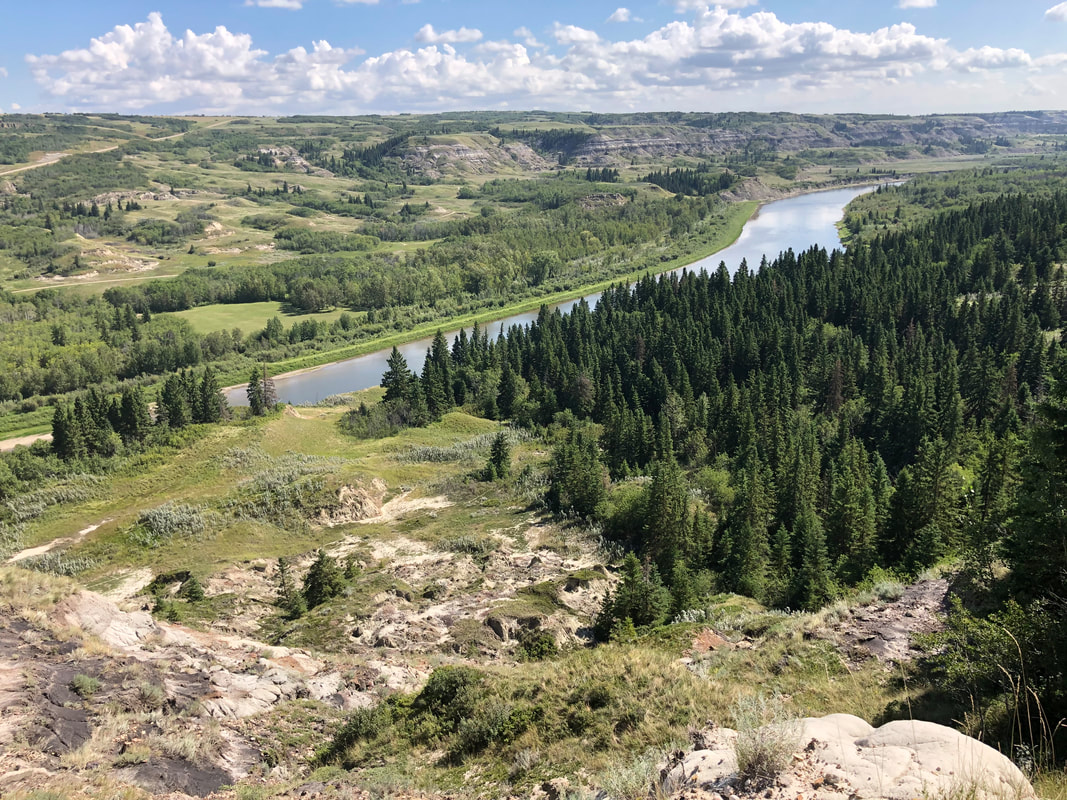


photo credit: Alia Snively (1) and Shaye Hill (2 & 3)
Wetaskiwin Lions Trout Pond - ACA Fish Stocking (85.6 km)
This pond is located on the northeast side of Wetaskiwin. Annually, the ACA (Alberta Conservation Association) restocks this pond with trout, usually just before the May long weekend. The area surrounding the pond features benches, providing visitors with a comfortable spot to enjoy the waterfowl and the serene environment. The Wetaskiwin Lions Campground was well-maintained and kept very clean. It offers a 52-site RV Campground operated by the Wetaskiwin Lions Club. The campground provides various amenities, including a playground, two camp kitchens, a fish pond, toilets and showers, firewood, laundry facilities, horseshoe pits, and a dumping station.
Access: Located to the east of Highway 814 along Highway 13, you can find this site within the Wetaskiwin Lions Campground.
Partners: ACA, AEP, Wetaskiwin Lions Club
Alberta Discover Guide: D3-35
By-the-Lake Park (87 km)
Located just outside of Wetaskiwin, this park features a 2.4-kilometer loop trail, which is considered an easy route and typically takes a little over half an hour to complete. The trail follows a fully paved path encircling the lake, offering delightful views of the water and the lush forest. Whether you prefer mountain biking, running, or walking, this trail accommodates various activities, and you're unlikely to encounter many people during your exploration. The trail remains open year-round and retains its charm regardless of the season. Dogs are welcome on a leash, and numerous benches are scattered throughout the area for relaxation and enjoying the waterfowl. Additionally, visitors can find a playground for kids, a fountain on the water for aeration, and a publicly accessible washroom. Ample parking is available beside the Knights of Columbus Park Centre, which is situated south of the lake.
Access: To reach the park, simply travel west from Wetaskiwin on 56 Ave for 1.2 km, and you'll find the entrance on your right-hand side.
Partners: City of Wetaskiwin
Alberta Discover Guide: N/A
Krause H (87.2 km)
Situated approximately 12 km southwest of Bittern Lake, this 156-acre site encompasses a diverse range of habitats, including upland, riparian, and wetland areas. In close proximity, there is an oil field gate and lease. The property features forest groves consisting of poplar and aspen, while the majority of the site is grassland. There is at least one wetland present on-site, along with an acreage located in the southern part of the property. Occasionally, the site undergoes cultivation. Noteworthy bird species in the area include the Song Sparrow, Rose-breasted Grosbeak, and Red-tailed Hawk.
Access: Proceed south on Range Road 221 departing from Bittern Lake. Make a westbound turn onto Township Road 462 and continue for 3.2 km. Afterward, turn south onto Range Road 223. In approximately 2.4 km, you will find the property situated on your right-hand side, just after passing Eikerman.
Partners: DUC
Alberta Discover Guide: D3-67

Open Creek Natural Area – 87.8 km from Red Deer
Partners: Alberta Environment and Parks
https://www.albertaparks.ca/parks/central/open-creek-na/
Partners: Alberta Environment and Parks
https://www.albertaparks.ca/parks/central/open-creek-na/
Eikerman - #44 in Alberta Discover Guide - 87.9 km from Red Deer
This 160-acre site is approximately 30 km SW of Camrose and consists of a mix of upland aspen forest and small wetlands in which moose, white-tailed deer, and grouse abound. To access, travel S on Highway 822 from the hamlet of Gwynne, then E on Twp Rd 462 and S on RR 223 for 1.6 km. This is the NE corner of the property.
Partners: Alberta Conservation Association, Alberta Environment and Parks
http://www.albertadiscoverguide.com/site.cfm?grid=D3&number=44
Millet Fish and Game - #14 in Alberta Discover Guide – 87.9 km from Red Deer
This 154-acre site is approximately 16 km SW of Millet and is managed by the Millet Fish & Game Club.
Partners: Alberta Fish & Game Association, Millet Fish & Game
http://www.albertadiscoverguide.com/site.cfm?grid=D3&number=14
This 154-acre site is approximately 16 km SW of Millet and is managed by the Millet Fish & Game Club.
Partners: Alberta Fish & Game Association, Millet Fish & Game
http://www.albertadiscoverguide.com/site.cfm?grid=D3&number=14
Welch Creek Natural Area – 88.9 km from Red Deer
Partners: Alberta Environment and Parks
https://www.albertaparks.ca/parks/central/welch-creek-na/
Partners: Alberta Environment and Parks
https://www.albertaparks.ca/parks/central/welch-creek-na/

Baron - #111 in Alberta Discover Guide - 90.2 km from Red Deer
This 160-acre site is approximately 13 km N of Stettler and consists of wetland, grassland and bush habitat. Wildlife in the area includes moose, white-tailed and mule deer and waterfowl.
Partners: Ducks Unlimited Canada
http://www.albertadiscoverguide.com/site.cfm?grid=E3&number=111
This 160-acre site is approximately 13 km N of Stettler and consists of wetland, grassland and bush habitat. Wildlife in the area includes moose, white-tailed and mule deer and waterfowl.
Partners: Ducks Unlimited Canada
http://www.albertadiscoverguide.com/site.cfm?grid=E3&number=111
George & Joan Mitchell Memorial (91.4 km)
Situated on the west side of Pigeon Lake, this site mainly consists of open grassland and groves with willows. In the southern half of the quarter, Tide Creek can be found coursing through the property, offering an excellent habitat for trout spawning. In the northeast region, the property features a mixed forest with lots of deadfall. Some noteworthy species include the Red-eyed and Philadelphia Vireo, whose calls can easily be heard from the forest. There are a few game trails and some leftover vehicle tracks, making navigation through the open fields relatively straightforward. However, there are no washrooms on site. The site is located across from AFGA's Pigeon Lake Property and is fenced to mark the boundary. It is surrounded by forest, acreages, and the roadway.
Access: Starting from the Village of Pigeon Lake intersection, travel west on Highway 13 for 3.2 km, then turn right (north) onto Highway 771. After 14 km, make a left onto Township Road 472, and then take a right onto Range Road 22. After 1.1 km, you can park in the pull-out located on the right-hand side. While it is a long distance from Red Deer, the site is still easy to access. Parking is available for one or two vehicles in the pull-out.
Partners: ACA, AEP, AFGA, Zone 3 Fish & Game clubs
Alberta Discover Guide: D3-26
Pigeon Lake Sanctuary (91.7 km)
The majority of this site is densely populated with white spruce and trembling aspen forests, making navigation difficult. However, despite the lack of trails, the location is ideal for roadside viewing, allowing observation of wildlife such as beavers and waterfowl. Tide Creek runs throughout the southern half of the property, while there is an oil lease in the northern region which can be used as a trail. By following this path, you can find an active pumpjack on this site. Parking space for 1-3 cars is available by this oil lease road. This site is also located west from the George and Joan Mitchell Memorial property.
Access: Starting from the Village of Pigeon Lake intersection, travel west on Highway 13 for 3.2 km, then turn right (north) onto Highway 771. After 14 km, make a left onto Township Road 472, and then take a right onto Range Road 22. After 1.1 km, you can park in the pull-out located on the right-hand side (Pigeon Lake Sanctuary is situated on the west side of the road).
Partners: ACA, AEP, AFGA, Zone 3 Fish & Game clubs
Alberta Discover Guide: D3-89
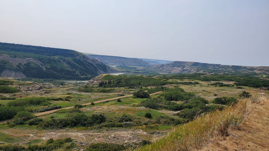
Dry Island Buffalo Jump Provincial Park – 92.5 km from Red Deer
This natural area offers spectacular views of the Red Deer River Valley showcasing badland topography. There are over 150 species of birds that can be found in this location along with numerous wildlife species. Paddlers can access the river and there are picnic tables for use.
Partners: Alberta Environment and Parks
https://albertaparks.ca/parks/central/dry-island-buffalo-jump-pp/
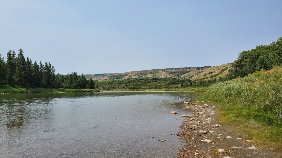
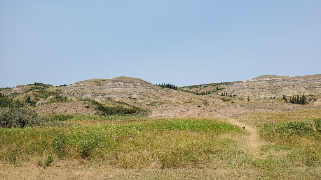
Snakes Head Natural Area (92.6 km)
This site encompasses various features, including floodplain areas and braided channels of the Red Deer River, upland terrain, and east-facing embankments. The natural area also hosts riverine balsam poplar woodlands, stands of aspen, and mixed woodlands. To access this location, it is recommended to have a truck or SUV due to the presence of large pot holes on the road. Additionally, it's important to note that the road can become flooded at times, depending on the year. The nearby river also has a fast-moving current in some areas, making it unsuitable for families with small children. Moreover, be cautious about where you park, as the ground is scattered with rusty nails, remnants from an old burn pile.
Access: Starting from Sundre, travel east on the Cowboy Trail and take a left (north) onto Range Road 52. After 6.9 km, make a left onto Township Road 334. Continue on a fair-weather road until you reach the riverbank.
Partners: AEP
Alberta Discovery Guide: N/A
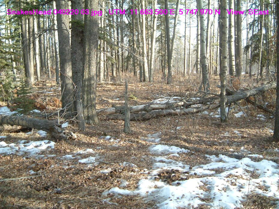
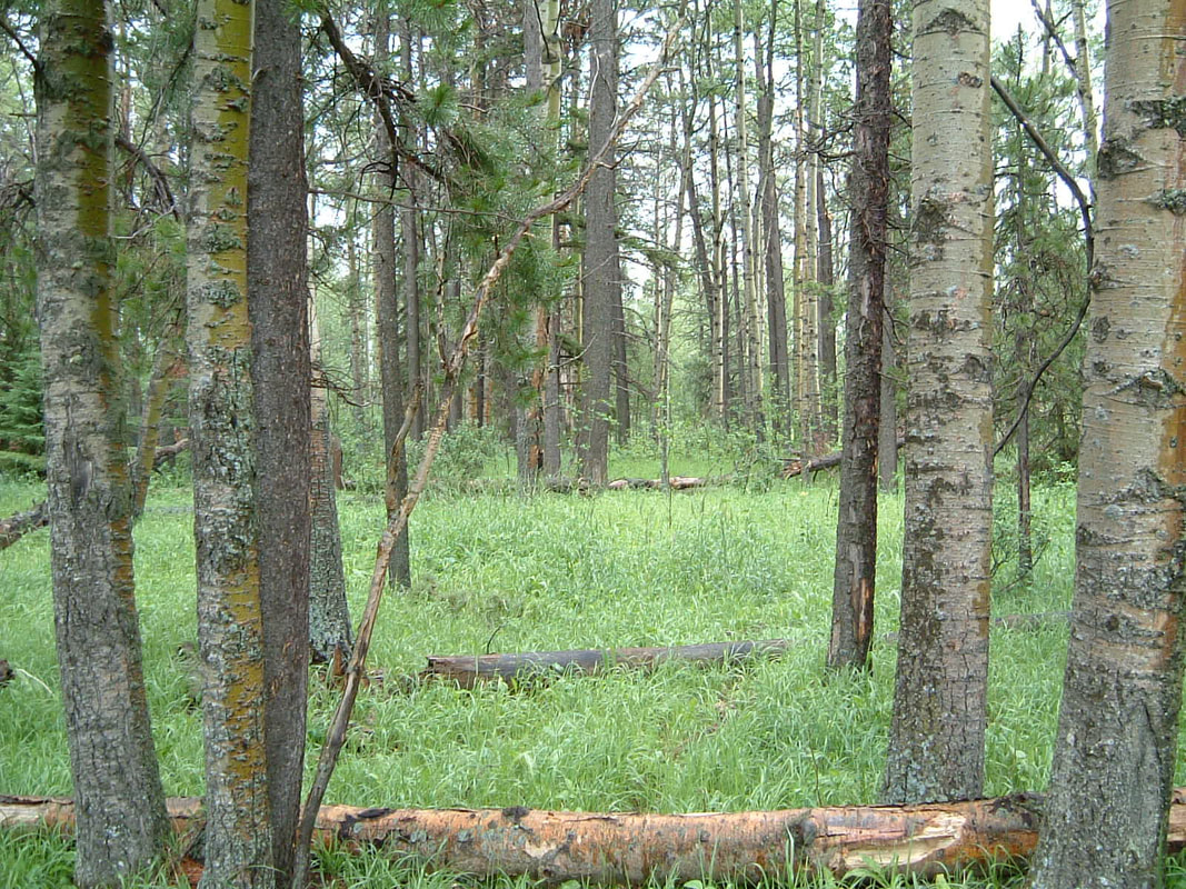
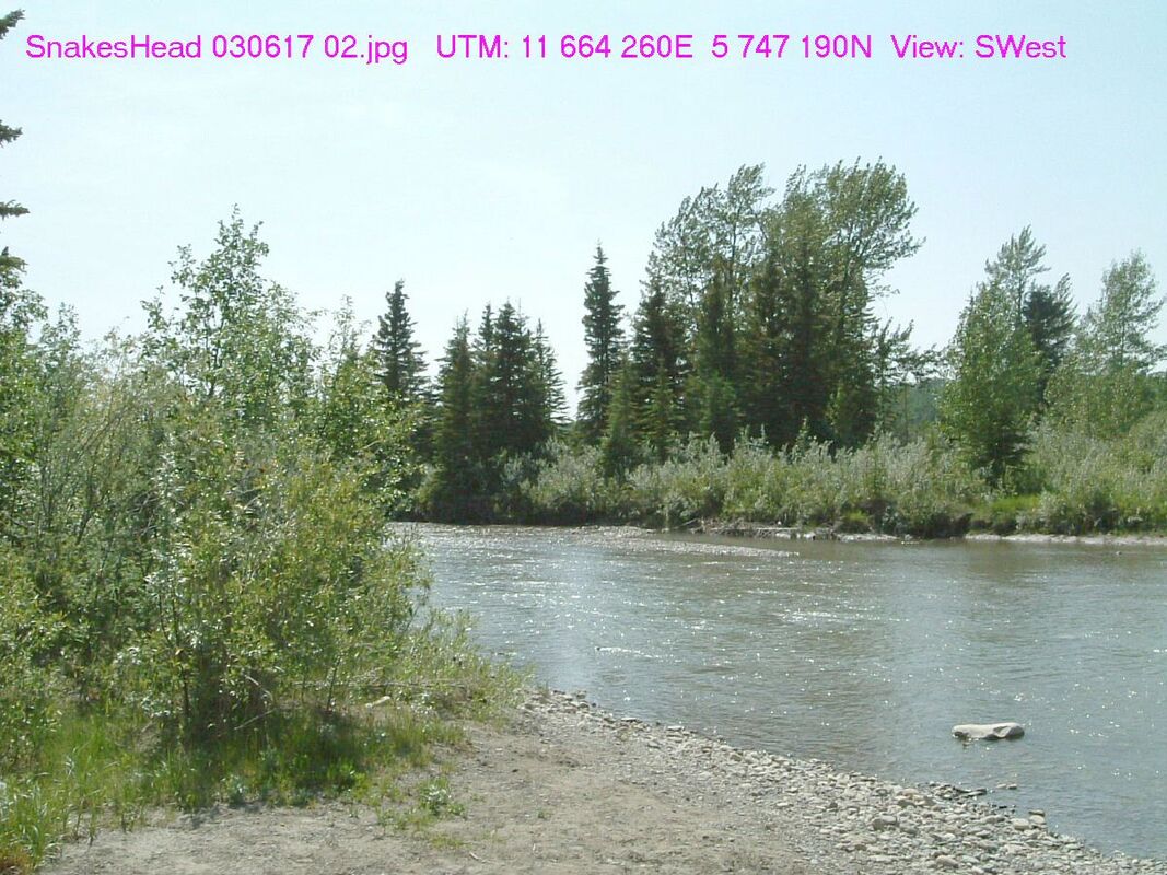
photo credit: Tony Blake
Cow Lake Natural Area – 92.9 km from Red Deer
Partners: Alberta Environment and Parks
https://www.albertaparks.ca/parks/central/cow-lake-na/
Partners: Alberta Environment and Parks
https://www.albertaparks.ca/parks/central/cow-lake-na/
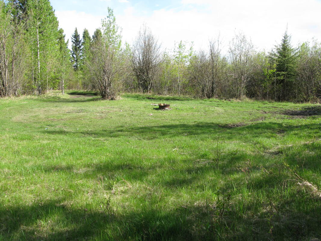

photo credit (first 2 images): Tony Blake
Chedderville Natural Area – 93.7 km from Red Deer
This natural area is 566 acres surrounding the Clearwater River covered in a mixed-wood boreal forest with mature spruce, trembling aspen and balsam forests. The wildlife in the area include white-tailed and mule deer, black bears, red squirrel, and forest birds.
Partners: Alberta Environment and Parks
https://albertaparks.ca/parks/central/chedderville-na/
Simon (94.0 km)
This location is situated to the northeast of Stettler and offers easy access for visitors. Within the area, you will encounter features commonly found in aspen parkland, such as expansive grasslands, wetlands, and clusters of aspen trees. On the eastern side, there is an access point, and upon arriving at the entrance, a cattle corral is visible, providing a vantage point to oversee most of the site. In the southeastern corner of the quarter, you'll find a subdivision named Willow Glen, comprising several privately-owned properties. The site features no trails but is ideal for birdwatching, including species like the Horned Grebe, Baltimore Oriole, Eastern Kingbird, Blue Heron, Vesper Sparrow, and Warbling Vireo. Along the roadside, you can spot small flowering vegetation, such as fireweed and sweet clover. The location offers easy access, and while there are no washrooms on-site, road-side parking is available for convenience.
Access: Begin from Stettler and travel north along Highway 56 for a distance of 11.6 km. Afterward, make a right turn onto Township Road 402 and continue heading east for approximately 1.6 km. Then, take a left turn onto Range Road 193 and proceed until you come across the approach, which will be situated on the left-hand side.
Partners: DUC
Alberta Discover Guide: E3-105
Link (94.2 km)
This 160-acre conservation site is situated 25 km southeast of Bashaw and is located northwest of the Buffalo Lake Moraine Conservation Area. In 2007, Tree Canada and Shell Canada collaborated to plant aspen whips in an old hayfield on this land. Since then, the native vegetation has rapidly re-established. The site predominantly consists of open grassland and rolling hills, interspersed with a few wetlands. To access the site, you can head to the northeast corner, where you'll find the entrance point marked with DUC (Ducks Unlimited Canada) signage. In this area, you'll come across planted spruce trees, along with Saskatoon and Chokecherry bushes. The site's wetlands are frequented by various waterfowl species, including the Canvasback, Redhead, and Blue-winged Teal. While there are no washrooms or garbage facilities available, there are plenty of opportunities to view waterfowl from the road.
Access: To reach the site, start by traveling east from Bashaw on Highway 53, covering a distance of 15 km. Then, make a southward turn onto Range Road 200 and continue for 8.2 km. The northeast corner of the site will be on your right-hand side at that point.
Partners: ACA, AFGA
Alberta Discover Guide: E3-140
Kramer Pond - #8 in Alberta Discover Guide - 94.9 km from Red Deer
This 33-acre site is approximately 4 km S of Buck Lake. To access this site, travel W of Winfield to the Buck Lake turnoff. Travel S for 3.2 km, then E for 0.6 km, and then N into the site. AEP stocks the pond annually with trout. Facilities include a parking area, garbage bins, a fish cleaning stand and outhouses.
Partners: Alberta Conservation Association, Alberta Environment and Parks
https://www.albertadiscoverguide.com/site.cfm?grid=D3&number=8
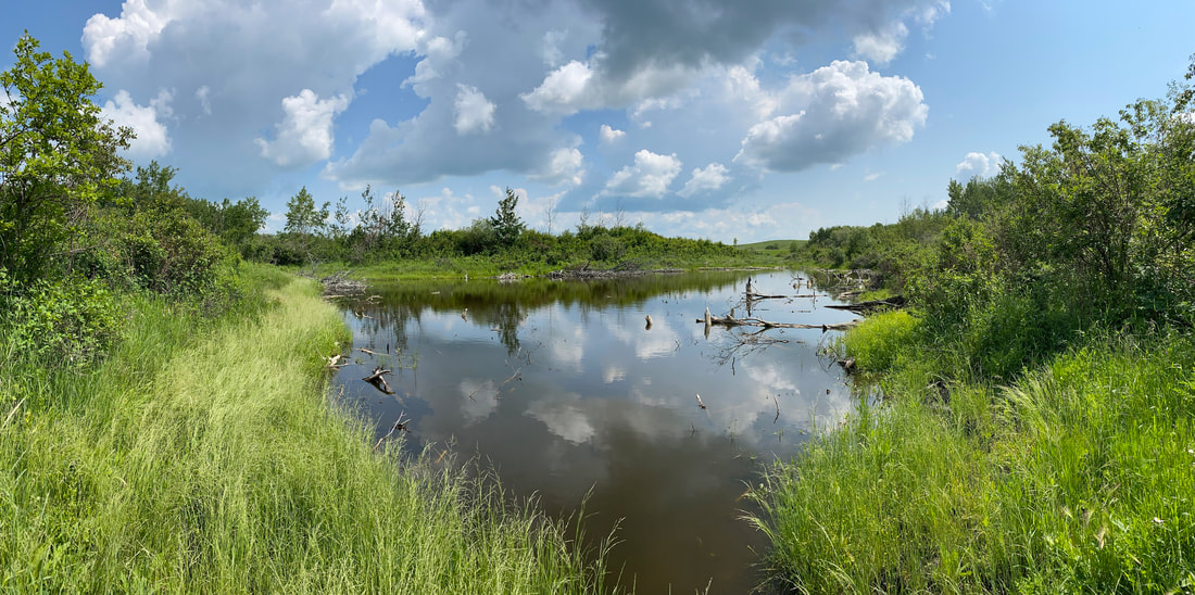
Potter’s Seep (96.0 km)
When you first reach Potter's Seep, you will enter a spacious parking lot capable of accommodating 10+ cars. From here, a meandering trail winds through the area, offering opportunities to explore at your own pace. Along the path, you'll find interpretive signs that provide valuable insights, allowing you and your family to guide yourselves through the property. The trail encompasses both wetlands and open areas, offering a diverse experience. This trail is named after Jim Potter, a former employee of the Alberta Conservation Association (ACA), and his brother Steve. They dedicated numerous hours to restoring the seep to its natural state.
Access: Starting from Stettler, head north on Highway 56 for 18 km. After passing Township Rd 410, pull off the highway into the parking lot situated on the left-hand side.
Partners: AFGA, Buffalo Lake Naturalists, DUC, ACA, County of Stettler, NCC
Alberta Discover Guide: E3-110
Caine 4 - #156 in Alberta Discover Guide - 96.7 km from Red Deer
This 160-acre site is approximately 16 km N of Stettler along Highway 56 and consists of native parkland with a mix of wetland, grassland and bush habitat. Wildlife in the area includes white-tailed deer and waterfowl.
Partners: Ducks Unlimited Canada
http://www.albertadiscoverguide.com/site.cfm?grid=E3&number=156
Caine 3 - #158 in Alberta Discover Guide - 96.8 km from Red Deer
This 320-acre site is approximately 30 km SE of Bashaw. Travel E on Highway 53 from Bashaw to Highway 56. Turn S on Highway 56 and travel 11 km to the site on the E side of the highway. Access is via the Caine 4 Conservation Site (E3-156) along Highway 56. Habitat at the site consists of native parkland with a mix of aspen-covered rolling hills, open meadows and numerous wetlands. Wildlife includes white-tailed and mule deer, ruffed grouse and waterfowl.
Partners: Alberta Conservation Association, Alberta Fish & Game Association, Ducks Unlimited Canada, Nature Conservancy of Canada
http://www.albertadiscoverguide.com/site.cfm?grid=E3&number=86
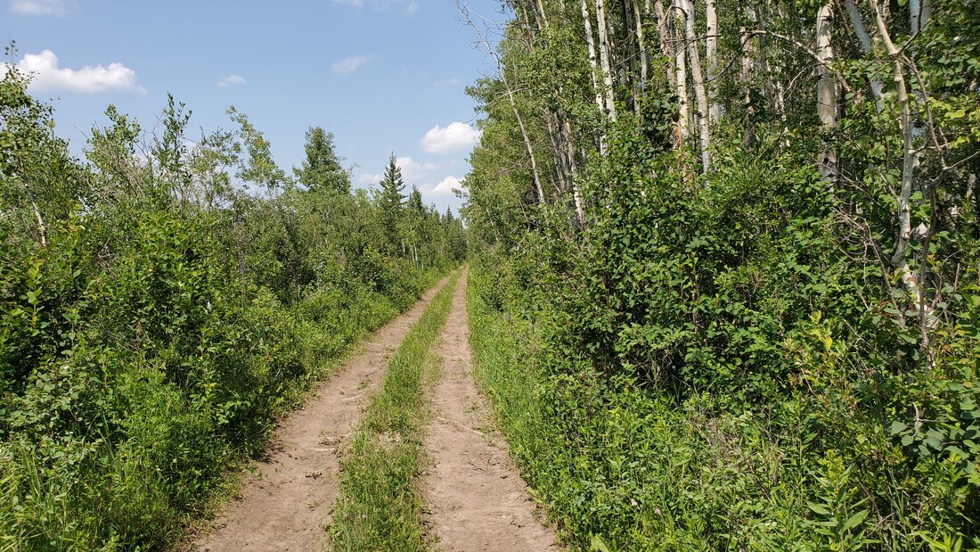
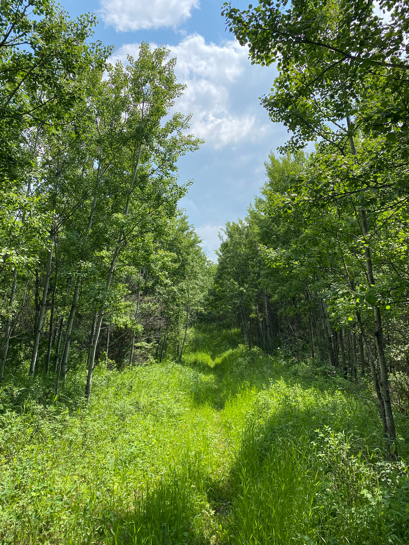
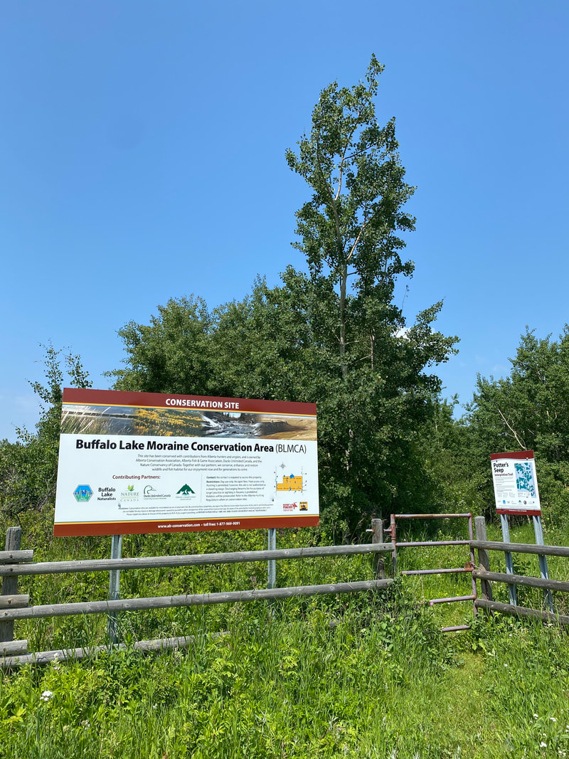
Buffalo Lake Moraine Conservation Area - #110 in Alberta Discover Guide - 97.5 km from Red Deer
This site is approximately 19 km SE of Bashaw. A parking lot off Highway 56 provides access to the site's E side. Access to the W side is along RR 20-0. Totaling 1,120 acres in the Parkland Buffalo Lake Moraine, this site spans richly varied habitat. Wildlife in the area includes moose, white-tailed and mule deer, great crested flycatcher, pileated woodpecker and rose-breasted grosbeak. An interpretive walking trail leads to Potter's Seep, where you'll find a picnic table and a spring within a balsam poplar grove recognized by the Heritage Tree Foundation of Canada.
Partners: Alberta Conservation Association, Alberta Fish & Game Association, Ducks Unlimited Canada, Nature Conservancy of Canada, TD Friends of the Environment Foundation
http://www.albertadiscoverguide.com/site.cfm?grid=E3&number=110
Wilson Creek Natural Area – 97.6 km from Red Deer
Partners: Alberta Environment and Parks
https://www.albertaparks.ca/parks/central/wilson-creek-na/
Partners: Alberta Environment and Parks
https://www.albertaparks.ca/parks/central/wilson-creek-na/
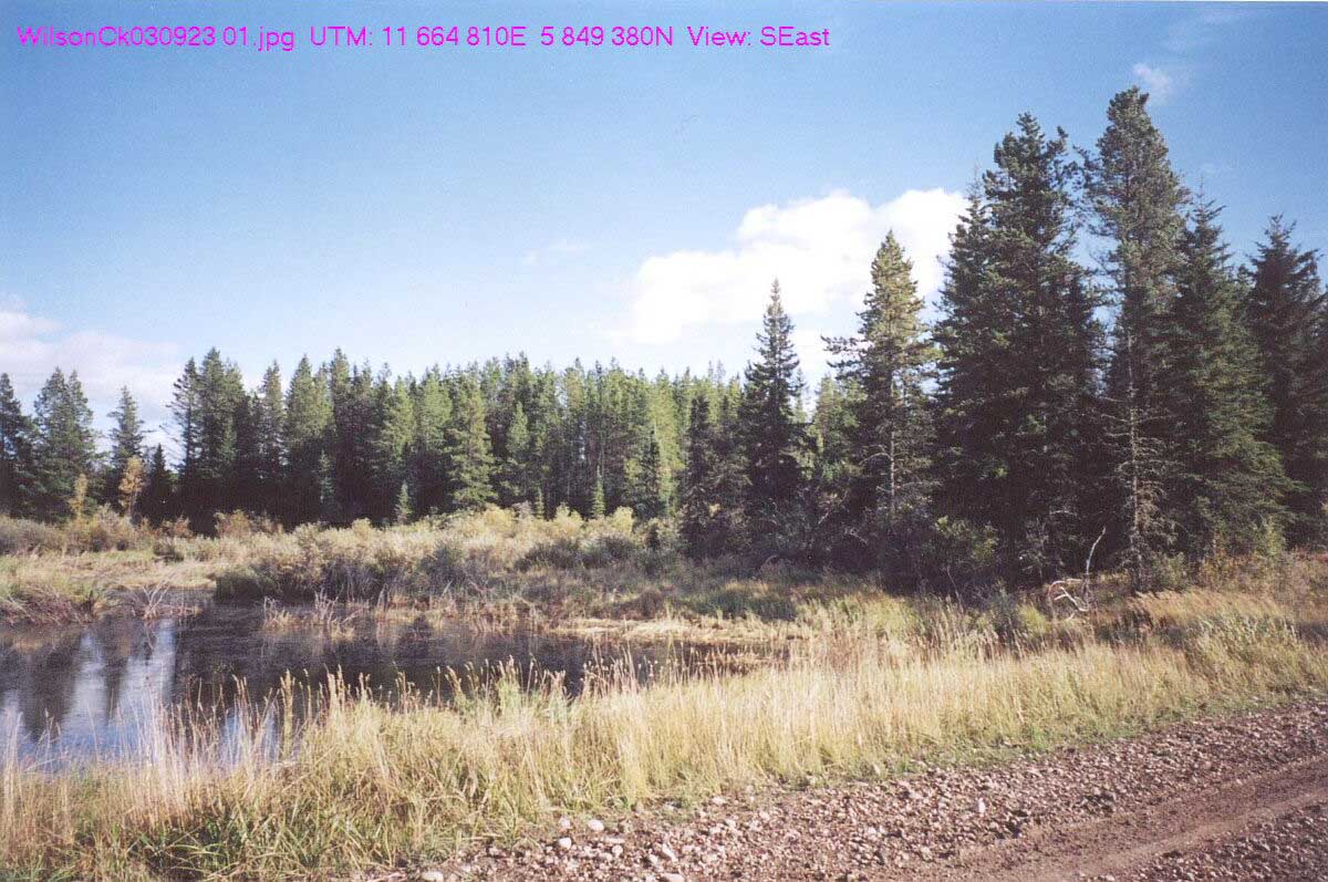
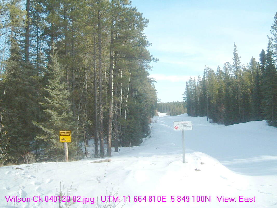
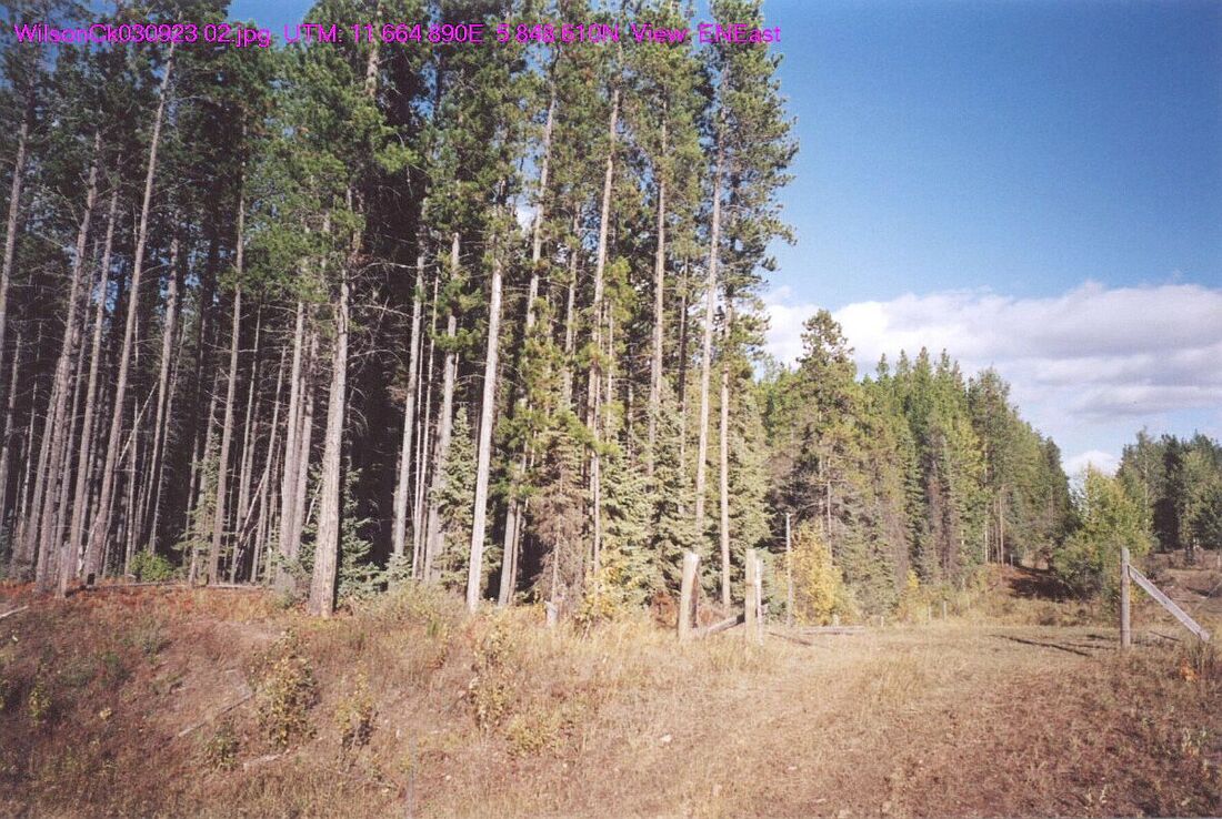
photo credit: Tony Blake
Blue Sky 22 – #110 in Alberta Discover Guide - 97.7 km from Red Deer
This 160-acre site is approximately 1 km E of Bittern Lake and consists of upland, riparian and wetland habitat. Wildlife in the area includes moose, white-tailed and mule deer, grouse and waterfowl.
Partners: Ducks Unlimited Canada
http://www.albertadiscoverguide.com/site.cfm?grid=D3&number=110
This 160-acre site is approximately 1 km E of Bittern Lake and consists of upland, riparian and wetland habitat. Wildlife in the area includes moose, white-tailed and mule deer, grouse and waterfowl.
Partners: Ducks Unlimited Canada
http://www.albertadiscoverguide.com/site.cfm?grid=D3&number=110
Crimson Lake Provincial Park – 98.0 km from Red Deer
Partners: Alberta Environment and Parks
https://www.albertaparks.ca/parks/central/crimson-lake-pp/
Partners: Alberta Environment and Parks
https://www.albertaparks.ca/parks/central/crimson-lake-pp/
Clearwater Ricinus Natural Area (99.0 km)
Situated adjacent to the Clearwater River, this area is characterized by steep banks and tree stands primarily consisting of aspen and balsam poplar trees, with some white spruce interspersed. Numerous quad trails crisscross the property, providing pathways for walking and exploration. As you venture off the trails, the forest reveals its dense nature, and should you choose to continue forward, you'll eventually reach an opening that offers a view of the nearby highway. A leftward path from here leads to a trail guiding you down to the Clearwater River. Alternatively, other trails within the forested terrain provide a different hiking experience.
Access: To access the site, travel west of Caroline on Highway 54. Before reaching the bridge, make a left onto Range Road 65A. Keep an eye on your right as the road curves, and look for a bright yellow sign labeled 'Natural Area Boundary.' You can park along the ditch in this area. Please be aware: GPS directions might suggest a left turn at the intersection after the bridge, but this would lead you to the opposite side of the river. Note that this access point might appear somewhat concealed and steep.
Partners: AEP
Alberta Discover Guide: N/A
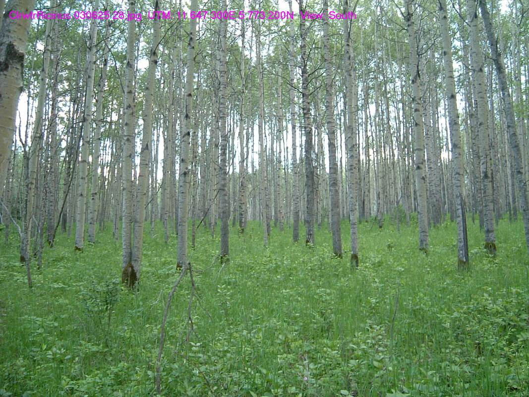
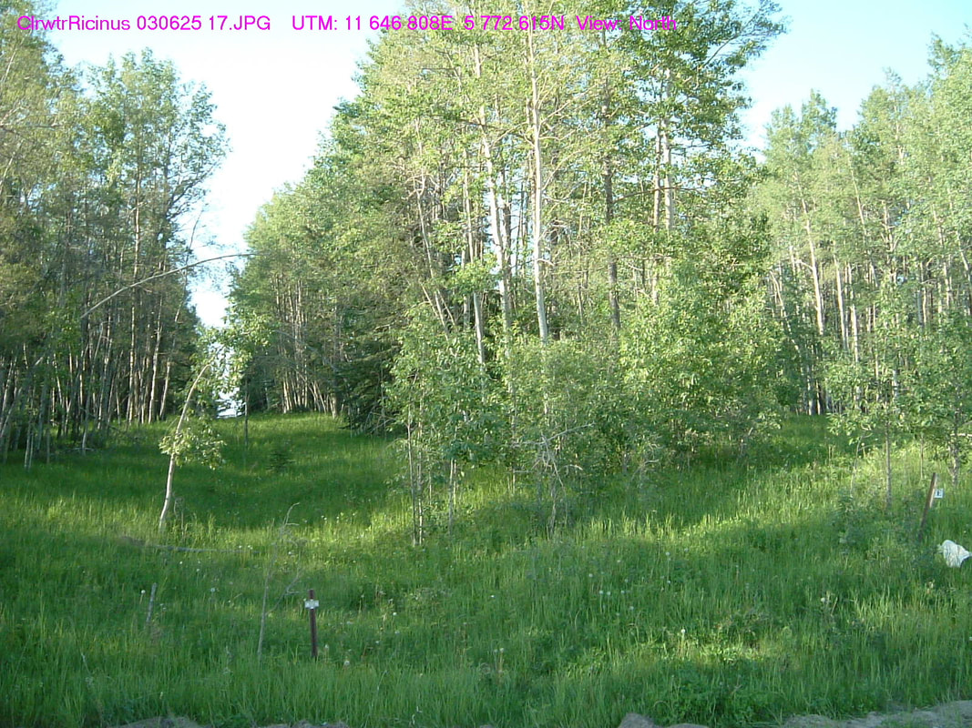

photo credit: Tony Blake
Larose (99.1 km)
Spanning 148 acres, this area is situated approximately 28 km southeast of Bashaw and is characterized by its native parkland habitat. Within the property, wild onions flourish in abundance. However, it's important to note that access to the site is very poor. The location is positioned adjacent to a busy highway, and in some areas, it is enclosed with sheep wire fencing, which can make passage challenging. The previously accessible point has been converted into a private driveway. However, if your vehicle can handle off-road conditions, you may choose to park along the west side of the highway. Here, you will still be able to observe waterfowl in the wetland area, with species like the Canvasback present, depending on the time of the year. Please be aware that there are no washrooms or garbage facilities available on-site.
Access: To access the site, begin your journey by traveling east on Highway 53 from Bashaw until you reach Highway 56. Then, head south on Highway 56 for a distance of 8.5 km, and you'll find the site located on the east side of the highway.
Partners: ACA, DUC, NCC
Alberta Discover Guide: E3-8
Hiller - #158 in Alberta Discover Guide - 99.1 km from Red Deer
This 320-acre site is approximately 16 km NE of Stettler and consists of wetland, grassland and bush habitat. Wildlife in the area includes white-tailed deer and waterfowl.
Partners: Ducks Unlimited Canada
http://www.albertadiscoverguide.com/site.cfm?grid=E3&number=158
This 320-acre site is approximately 16 km NE of Stettler and consists of wetland, grassland and bush habitat. Wildlife in the area includes white-tailed deer and waterfowl.
Partners: Ducks Unlimited Canada
http://www.albertadiscoverguide.com/site.cfm?grid=E3&number=158
Dennis Brothers - #74 in Alberta Discover Guide - 99.1 km from Red Deer
This 320-acre site is approximately 16 km N of Stettler and consists of wetland, grassland and bush habitat. Wildlife in the area includes white-tailed and mule deer and waterfowl.
Partners: Ducks Unlimited Canada
http://www.albertadiscoverguide.com/site.cfm?grid=E3&number=74
This 320-acre site is approximately 16 km N of Stettler and consists of wetland, grassland and bush habitat. Wildlife in the area includes white-tailed and mule deer and waterfowl.
Partners: Ducks Unlimited Canada
http://www.albertadiscoverguide.com/site.cfm?grid=E3&number=74
Dennis Doug - #14 in Alberta Discover Guide - 99.1 km from Red Deer
This 160-acre site is approximately 16 km N of Stettler and consists of wetland, grassland and bush habitat. Wildlife in the area includes white-tailed and mule deer and waterfowl. Access through Dennis Brothers property.
Partners: Ducks Unlimited Canada
http://www.albertadiscoverguide.com/site.cfm?grid=E3&number=14
Dennis - #50 in Alberta Discover Guide - 99.1 km from Red Deer
This 160-acre site is approximately 15 km N of Stettler and consists of wetland, grassland and bush habitat. Wildlife in the area includes white-tailed and mule deer and waterfowl. Access through Dennis Brothers property and through the Dennis Doug property.
Partners: Ducks Unlimited Canada
http://www.albertadiscoverguide.com/site.cfm?grid=E3&number=50
Rasmuson 10 – #125 in Alberta Discover Guide - 100.00 km from Red Deer
This 160-acre site is approximately 18 km NW of Bittern Lake and consists of upland, riparian and wetland habitat. Wildlife in the area includes moose, white-tailed and mule deer, grouse and waterfowl.
Partners: Ducks Unlimited Canada
http://www.albertadiscoverguide.com/site.cfm?grid=D3&number=125
This 160-acre site is approximately 18 km NW of Bittern Lake and consists of upland, riparian and wetland habitat. Wildlife in the area includes moose, white-tailed and mule deer, grouse and waterfowl.
Partners: Ducks Unlimited Canada
http://www.albertadiscoverguide.com/site.cfm?grid=D3&number=125