|
RDRN is pleased to announce the launch of a new and exciting ArcGIS Story Map. Called the Red Deer River Naturalists Mapping Project, this Story Map provides a visual representation of all of the protected areas within a 100 km radius of Red Deer, Alberta. Each protected area is colour-coded by stakeholder, with pop up tabs that provide information about each site and includes a link to the stakeholder’s website. The Story Map also depicts watersheds, municipal boundaries, First Nations Lands, and historical sites within the area. The goal of the Story Map is to help RDRN document, celebrate, and promote the respectful public enjoyment of the many protected areas in Central Alberta. We would like to thank Larissa Shevchenko, Ed Karpuk, and Tony Blake for developing this engaging Story Map. We invite feedback from anyone using the Story Map. Please feel free to contact us with your comments and suggestions. Link to the Story Map: Red Deer River Naturalists Mapping Project 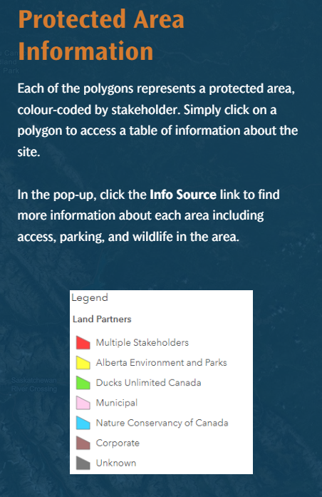 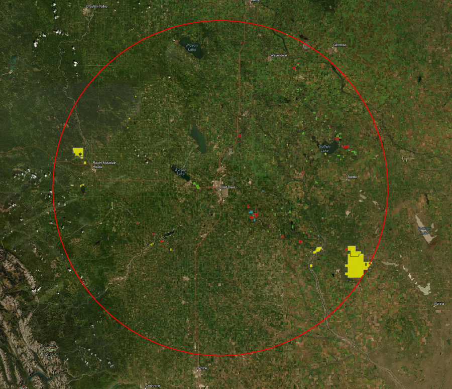 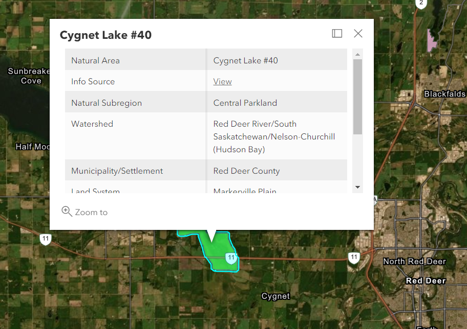 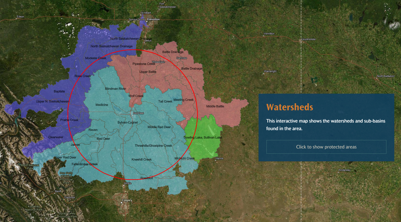  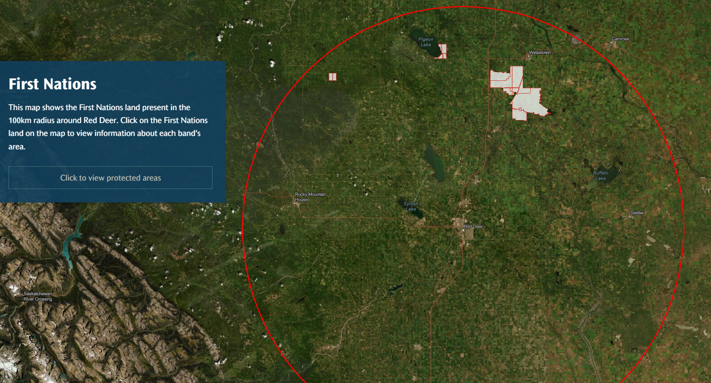 Comments are closed.
|